


Sapienza University
LIDAR (LIght Detection And Ranging) is a remote sensing device that uses the light pulses emitted by lasers to observe the atmosphere. The light pulses are scattered at the same wavelength (Rayleigh or Elastic LIDAR) or at different wavelength (e.g. RAMAN LIDAR) by the molecules or particulate of the atmosphere.
The BAQUNIN LIDAR has been designed and assembled using both custom-made and commercial equipment. Laser source, sensors, electronics and optics are commercial items, while frames and opto-mechanics were designed and built in the mechanical workshop of the Physics Department. The controlling software has been developed by the laboratory personnel. This modular approach allows a regular upgrading of each component and gives the possibility to add to the basic instrument new acquisition channels, in order to improve the system performance. Presently the system includes a large power pulsed laser, emitting 3 wavelengths, 4 receivers and 12 acquisition channels. A Quanta Ray Pro-290-30 laser produces pulses at three wavelengths, 1064, 532 and 355 nm. The three beams are directed to the vertical direction by adjustable mirrors and prisms. For safety reason and to prevent that laser light leakages could be picked up by the receivers, the beams travel inside black enclosures throughout the path from the laser head to the hatch in the roof.
The LIDAR signals are collected by four receivers:
Raman Receiver: a large telescope for collecting the signals in the UV range (elastic backscattering at 355 nm and 355-nm exited Raman backscattering from atmospheric N2 and H2O);
IR Receiver: a medium size telescope for collecting the elastic backscattering at 1064 nm;
532 Low Range Receiver: a small size telescope for collecting elastic backscattering at 532 from closer altitude range.
532 High Range Receiver: a medium size telescope for collecting the elastic backscattering at 532 nm from the medium altitude range; The acquisition system is based on 6 Transient Recorders TR20@LICEL. Each TR20 is equipped with an ADC as well as a Photon counter. Altogether 12 channels are available for the signals acquisition. The analogic channels are dedicated to the acquisition of the stronger elastic backscatter signals, while the photon counting is the method to digitalize the weak Raman backscattering from atmospheric water vapor and molecular nitrogen.
LIDAR can be operative in no-rain day and night conditions. From the inversion of the signals is possible to carry out the following atmospheric parameters:
- Tropospheric vertical profiles of the Aerosol and Cloud Backscatter Coefficients at 355, 532 and 1064 nm;
- Tropospheric vertical profiles of Aerosol and Cloud Extinction Coefficients at 355;
- Tropospheric vertical profiles of Aerosol and Cloud Polarization Ratio at 532;
- Aerosol and Cloud Optical Depths;
- Altitude and thickness of Aerosol and Cloud Layers;
- Tropospheric vertical profiles of the Water Vapor Mixing Ratio.
PI: Marco Cacciani
OWNER: Sapienza
PRODUCTS: Aerosol backscattering and extinction, H2O profiles, AOD, cloud boundaries

Raymetrics Aerosol Profiler
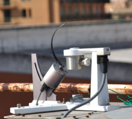
RAP (Raymetrics’ Aerosol Profiler), is a recently developed elastic backscatter mini-LiDAR. It is here to close the gap between ceilometers and high energy backscatter lidars. All QA and QC hardware and software tools based on ACTRIS requirements are included on basic configuration.
The system is suitable for cloud detection, tropospheric aerosol layers detection (i.e desert dust, biomass burning plumes, volcanic ash), PBL height studies. It delivers atmospheric backscatter aerosol profiles in the NIR with high raw spatial and temporal resolution 3.75m, <20sec, respectively. The effective range extends from full overlap (<200m) up to 15km.
General Utilities:
- 24/7 unattended operation
- Motorized actuators for remote alignment
- Motorized Telecover for remote alignment check
- Motorized blocking of the optical path for dark measurement acquisition
- Full remote control of all features
- Automatic data acquisition and storage
- Automatic web-based data analysis interface
Emission Section
- Microchip laser emitting at 1064nm
- ultra-compact size, low weight, high efficiency, low consumption, low heat load, maintenance free throughout the two-year lifetime (24/7 operation) and low cost for microchip replacement.
- Robust laser ideal for use in remote hostile environments (<00C) compared to water-cooled lasers.
- Eye safety from zero distance from the emitter aperture.
Receiver Section
- Big 200mm aperture receiver optimized for High Reflectance (>99.8%) @ 1064nm with custom designed HR coatings
- Specially designed Narrow band filters showing >90% transmittance @ 1064nm, out of band OD>6 to sufficiently suppress the atmospheric background.
- Adjustable telescope’s FOV 0.8mrad to 2.7mrad for advanced configuration capabilities of the lidar. Very low native full overlap [Q(z)=1] down to 200 meters. Making any complex algorithmic or experimentally procedure for data correction unnecessary.
Housing and Cooling
- Compact lightweight robust aluminium housing
- Thermal Stabilization by a 400Watt thermoelectric cooler sufficient to support operation of the instrument for external temperature varying from -10 to 400C. Low limit can be extended.
- The design ensures minimum alignment requirement.
- Birefringence free optical windows from Fused Silica glass (emission and transmission). Suitable for depolarization measurements (upgrade)
- In the default version the enclosure can be manually tilted from vertical to horizontal position allowing the performance of measurements within the PBL.
PI: Stefano Casadio
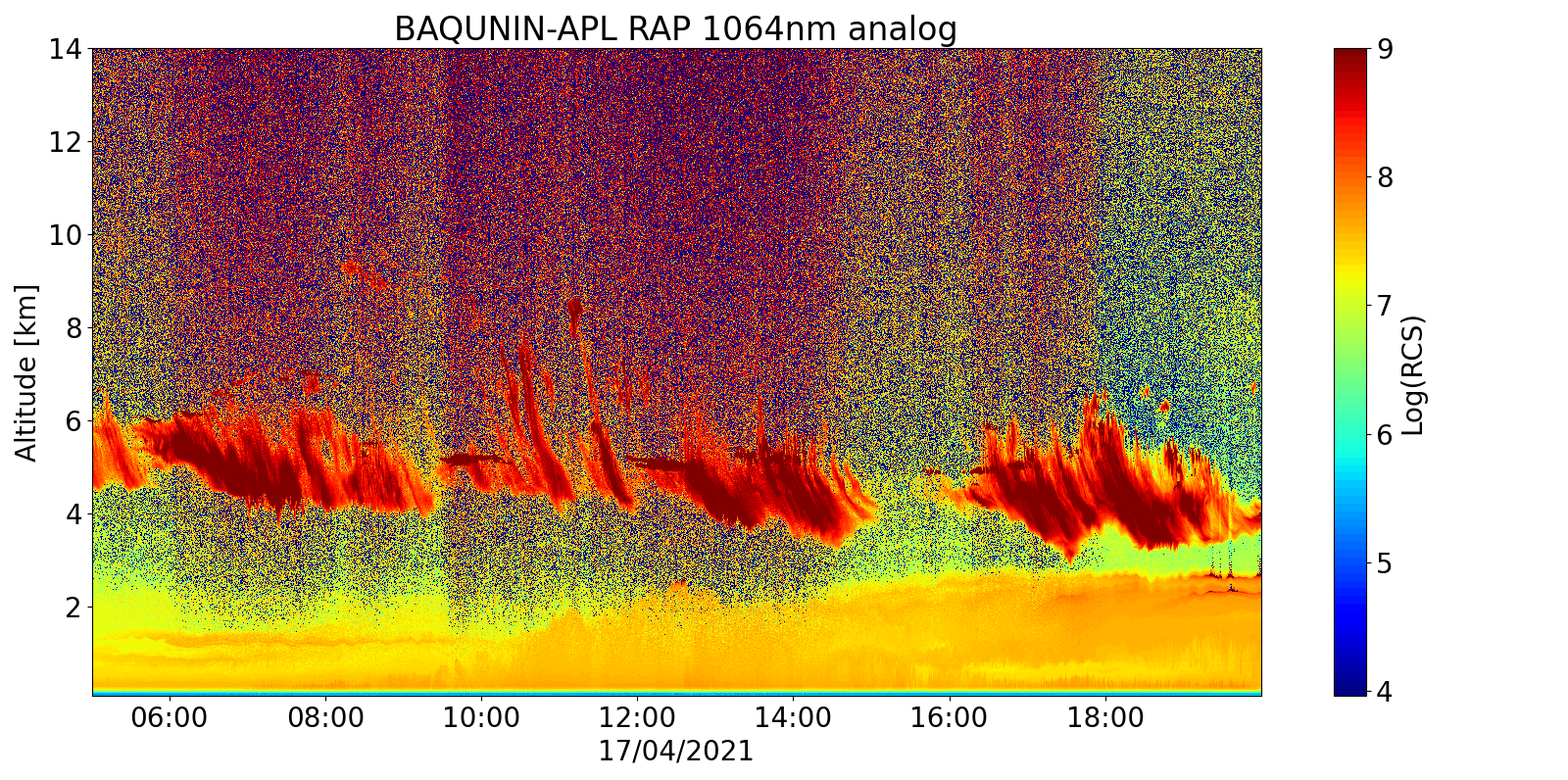
Range Corrected Signal RAP

Sapienza University
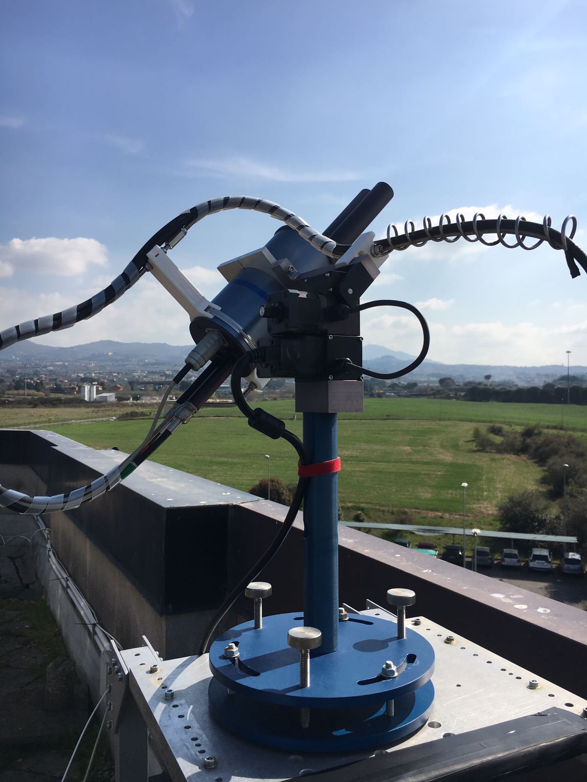
Monostatic multi-tone triaxial Doppler SODAR (which stands for “SOnic Detection And Ranging) is an active remote sensing instrument capable of retrieving both the three-dimensional wind filed and the thermodynamic structure up to the first 1000 m of atmosphere. SODAR systems principle of operation is based on the interaction of acoustic waves with the atmosphere: short sound pulses (typically between 50-300 ms at 1-3 kHz) are emitted in the atmosphere, and the echoed signals scattered back by the small-scale thermal turbulence from different atmospheric layers are recorded. In the monostatic configuration, the transmitter and the receiver are co-located, and oriented along the same axis. The intensity and the Doppler shift of the returned signal are used to retrieve, respectively, the atmospheric thermal turbulence and the wind radial velocity, that is the wind velocity along the axes of the antenna. Although the thermal structure and the vertical velocity could be retrieved using a single vertically oriented beam, a three-dimensional wind profile needs at least three beams oriented along different axis. The SODAR working in BAQUNIN Super Site is in the triaxial configuration, allowing to retrieve vertical and horizontal wind velocity. The instrument is operative since 2014.
REF: Casadio, S., M.P. Rao, G. Fiocco, M. Cacciani, A. di Sarra, D. Fuà, and P. Castracane, “Estimation of atmospheric water vapor flux profiles in the nocturnal unstable urban boundary layer with Doppler sodar and Raman lidar”, Boundary-Layer Meteorol., 102, 39-62, 2002
Casadio, S., A. di Sarra, D. Fuà, M.P. Rao, and G. Fiocco “Raman lidar and Doppler sodar observations of the nocturnal urban boundary layer at Rome, Italy, during 1994 and 1995”, in Advances in Atmospheric Remote Sensing with Lidar (Ansmann, Neuber, Rairoux and Wandinger eds.), Springer-Verlag, 27-30, 1997
PI: Annalisa Di Bernardino
OWNER: Sapienza
PRODUCTS: Thermal turbulence, wind speed and direction profiles
a
Sapienza University
The visible Multifilter Rotating Shadowband Radiometer (MFRSR) is a passive instrument that measures global and diffuse components of solar irradiance at six narrowband channels and one open, or broadband, channel.
The main components are the head that houses the filter detectors and amplification circuitry, the stepper motor with shadowband and the mounting frame. The instrument is set up with the motor aligned toward the Equator. The stepper motor and shadowband alternately cover and uncover the diffuser, allowing measurements of global and diffuse irradiance at six narrowband channels and one open channel to be made. Direct irradiance is calculated from the global and diffuse measurements.
To collect one data record, the MFRSR takes measurements at four different shadow-band positions:
- The initial measurement taken while the shadow-band is in the home position out of the 180° field of view. Sometimes called the nadir, or unblocked, measurement.
- Next, the first of two side-band measurements is taken. The two side-band measurements are used to correct for the signal lost due to the portion of the sky obscured by the shadow-band during the following measurement.
- Then, the sun-blocked measurement is taken. This is the measurement taken while the shadow-band’s shadow is cast over the diffuser.
- Finally, the second side-band measurement is taken. When this last measurement is completed, the shadowband then returns to the home position.
The first measurement is taken with the shadow-band in the nadir (home) position. The next three measurements are, in order, the first side-band, sun-blocked, and second side-band. The side-band measurements are used to correct for the portion of the sky obscured by the shadow-band. The nominal wavelengths of the narrowband channels are 415, 500, 615, 673, 870, and 940 nm. From such measurements, one may infer the atmosphere’s aerosol optical depth at each wavelength, the column abundances of ozone and water vapor.
REF: Harrison, L, J Michalsky, and J Berndt. 1994. “Automated multifilter rotating shadow-band radiometer: An instrument for optical depth and radiation measurements.” Applied Optics 33(22):5118-5125, doi:10.1364/AO.33.005118.
Harrison, L, and J Michalsky. 1994. “Objective algorithms for the retrieval of optical depths from groundbased measurements.” Applied Optics 33(22):5126-5132, doi:10.1364/AO.33.005126.
Michalsky, JJ, JC Liljegren, and LC Harrison. 1995. “A comparison of sun photometer derivations of total column water vapor and ozone to standard measures of same at the Southern Great Plains Atmospheric Radiation Measurement site.” Journal of Geophysical Research 100(D12):25,995-26,003, doi:10.1029/95JD02706
PI: Anna Maria Iannarelli
OWNER: Sapienza
PRODUCTS: Total column of AOD, O3, H2O

PTB 200 A dimensions in mm (inches)
The Vaisala PTB 200 A is a fully compensated digital barometer designed to operate over a wide pressure and temperature range. The final factory adjustment and calibration is done against a deadweight tester for best accuracy and pressure traceability. The barometer is adjusted and calibrated by using electronic working standards to meet the requirements of demanding weather station applications. The PTB 200 digital barometers use Vaisala’s BAROCAP silicon capacitive absolute pressure sensor, which is characterised by an excellent hysteresis and repeatability and very good temperature and long-term stability.
From April 1993, the PTB 200 digital barometers are traceable to National Institute of Standard and Technology (NIST) in the USA.
| OPERATING RANGE | |
| Pressure range | 600 … 1100 hPa |
| Operating temperature range | -40 °C … +60 °C |
| Storage temperature range | -60 °C … +60 °C |
| Humidity range | not impacting |
| Resolution | 0.01 hPa |
| Settling time after power-up | 2 second |
| Pressure step response time | 0.500 second |
| ACCURACY | |
| Linearity* | ±0.05 hPa |
| Hysteresis* | ±0.03 hPa |
| Repeatability* | ±0.03 hPa |
| Calibration uncertainty** | ±0.10 hPa |
| Accuracy at +20 °C *** | ±0.12 hPa |
| Temperature dependence | ±0.1 hPa / K |
| Total accuracy (RSS) | ±0.20 hPa |
| Long-term stability | ±0.1 hPa / year |
* Defined as the ±2 standard deviation limits of end-point nonlinearity, hysteresis error or repeatability error.
** Defined as ±2 standard deviation limits of inaccuracy of the primary or working standard at 1000 hPa in comparison to international standards (NIST).
*** Defined as the root sum of the squares (RSS) of end-point nonlinearity, hysteresis error, repeatability error and calibration uncertainty at room temperature.
REF: https://www.vaisala.com/sites/default/files/documents/PTB200_User_Guide_in_English.pdf
PI: Gabriele Mevi
OWNER: Sapienza

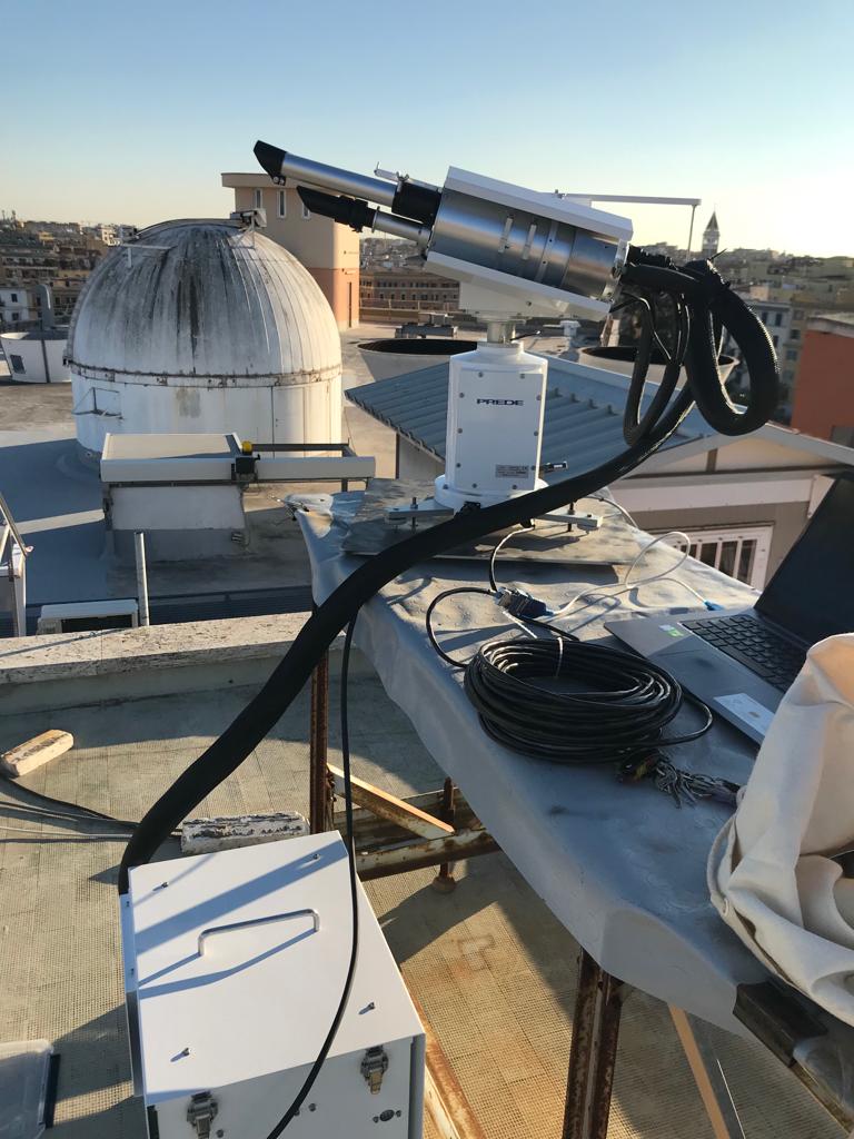 Prede POM01L Sun-sky radiometer
A sun–sky radiometer is a narrow band filter photometer able to perform measurements of direct solar and diffuse sky irradiances at some selected wavelengths (315, 400, 500, 675, 870, 940 and 1020 nm for model POM01, and 315, 340, 380, 400, 500, 675, 870, 940, 1020, 1675, 2200 nm for model POM02) and at several scattering angles in the Almucantar and Principal plane geometries. Measurements of direct irradiance are taken every 1 minute, and of diffuse sky irradiances every 10 minutes.
Two versions are available: Sun direct and diffuse irradiances and Sun and Moon direct and diffuse irradiances.
The optical system of the instrument is composed by a collimator tube 30 cm long; a convex lens is located at 70 mm from the sensor that is a silicon photodiode used for measuring both direct and diffuse solar flux radiation. A rotating filter wheel located between the lens and the sensor, holds the interferential filters for the selection of the wavelengths. The band width of each filter is about 10 nm. The optical view angle of the instrument is 1°. The optical system is equipped with an automatic solar tracker allowing to centre the solar disk, and to automatically follow its movement during the day.
Both filters and sensor are kept at a constant temperature (user definable between 0° to 40°) by a worming thermostat, for the UV, VIS and NIR wavelengths whereas are they refrigerated to 20° by an external cooling unit for the IR range.
The optical system is connected to the head of the instrument where two stepping motors, model VEXA 5-PHASE PH 564-N, control the azimuthal and zenithal movements. The instrument is equipped with a rain sensor that, connected with the stepping motors, allow to park the optical system in a position that prevent contamination from rain.
Two Sun-Moon sky radiometers PREDE-POMs are installed at the BAQUNIN supersite: POM01 and POM02 models and both are part of the International SKYNET (Skynet-isdc.org) and SKYNET/Europe (euroskyrad.net) networks.
REF: Campanelli at al., Monitoring of Eyjafjallajökull volcanic aerosol by the new European Skynet Radiometers (ESR) network (2012), Atmos.Environ., Volume 48, March 2012, doi:10.1016/j.atmosenv.2011.09.070
WEB: www.euroskyrad.net | www.skynet-isdc.org
PI: Monica Campanelli
OWNER: Sapienza/ESA for POM02, ISAC-CNR for POM01
Brewer spectrophotometer
The Brewer MKIV spectrophotometer is a modified Ebert grating spectrometer that has been designed to measure the intensity of attenuated solar radiation in the UV and Visible region.
Pointing capabilities of the instrument allow the measurement of direct irradiance, global irradiance, or polarized radiation scattered from the zenith sky. The column amount of atmospheric constituents that absorb or scatter solar or lunar radiation can be determined using differential optical absorption spectroscopy (DOAS) techniques. The atmospheric gases measured by the Brewer using their absorption properties include ozone (O3), sulfur dioxide (SO2), and nitrogen dioxide (NO2). In addition, aerosol optical depth can be determined from measurements of direct solar irradiance.
The most accurate method for determining the total column amount of a gas in the atmosphere is based on the direct sunlight (DS)measurements. It has been shown that the accuracy of measurements taken with a well-maintained Brewer spectrophotometer is 1% in the DS mode and 3%–4% in the zenith sky mode.
The algorithm to retrieve the total ozone column from the BrewerMKIV in DS mode is based on a differential measurement method involving four selected wavelengths in the ozone absorption spectra, nominally 310.1, 313.5, 316.8 and 320.1nm
The instrument was installed in 1992 and since then O3 and NO2 amounts, and UV irradiances have been systematically collected. Since its installation the Brewer has been calibrated every two years by intercomparison with the same traveling international reference Brewer 017 from International Ozone Services Inc. (IOS). This Brewer is in turn calibrated against the World Brewer Reference Triad in Toronto. In this way the ozone calibration is also traceable to the Brewer Reference Triad.In addition the Brewer data are regularly submitted to the WOUDC (World Ozone and Ultraviolet Radiation Data Centre) and took part to the COST Action ES1207 EUBREWNET (“A European Brewer Network” (EUBREWNET).
Such a long (more than 25 years) data collection of the total ozone content and UV irradiance allow to be used to validate the satellite-derived products, to investigate the long-short term ozone and UV variability, and to investigate the effects on human health induced by changes in exposure to solar UV radiation
REF: Siani, A. M., Frasca, F., Scarlatti, F., Religi, A., Diémoz, H., Casale, G. R., Pedone, M., and Savastiouk, V.: Examination on total ozone column retrievals by Brewer spectrophotometry using different processing software, Atmos. Meas. Tech., 11, 5105-5123, https://doi.org/10.5194/amt-11-5105-2018, 2018.
REF: Diémoz H., Siani A.M., Casadio S., Iannarelli A.M., Casale G.R., Savastiouk V., Cede A., Tiefengraber M., Müller M.: Advanced NO2 retrieval technique for the Brewer spectrophotometer applied to the 20-year record in Rome, Italy, ESSD, 13, 4929–4950, 2021, https://doi.org/10.5194/essd-13-4929-2021
PI: Anna Maria Siani
OWNER: Uni. Sapienza
Pandora 115
The Pandora 2S (dual spectrometer system) is a spectrometer system taking measurements in the spectral range 290-900 nm with a resolution of 0.6 nm.
It consists of a head sensor with fore-optics, mounted on a sun-tracker and sky-scanner controlled by a computer and connected to two array spectrometers by means of a 400 micron single strand multimode optical fiber. The system is capable of pointing anywhere in the sky in order to perform direct sun, zenith sky, principal plane, or almucantar observations with a 0.01° pointing precision.
The spectrometers are spectrally oversampled: multiple detector elements permits each spectrometer’s slit function to be determined in the laboratory using spectral line lamps and lasers, and improves the capability to match the spectrometer’s measurements with laboratory absorption coefficients and independently measured extraterrestrial solar irradiances.
Working in a wide spectral range, the instrument measures total columns and vertical profiles of trace gases such as nitrogen dioxide (NO2), ozone, formaldehyde (HCHO)an spectral aerosol optical depth (AOD) in the ultraviolet (>300 nm) and visible range.
A Pandora instrument can join the Pandonia network providing homogeneous calibration, central data processing and formatting, and quick delivery of final data products. The network born for ground-validation of Earth Observation (EO) missions devoted to air-quality monitoring and aerosols and for this reason the spectral range observed by Pandora instruments overlaps with the spectral ranges measured by the instruments on board the Sentinel 5 Precursor and EarthCARE missions.
BAQUNIN Super site hosts three Pandora instruments on for each location: Sapienza, Tor Vergata and Montelibretti, two of these are part of the Pandonia Global Network (PGN).
REF: Herman, R. Evans, A. Cede, N. Abuhassan, I. Petropavlovskikh, and G. McConville, Comparison of ozone retrievals from the Pandora spectrometer system and Dobson spectrophotometer in Boulder, Colorado, Atmos. Meas. Tech., 8, 3407–3418, 2015, doi:10.5194/amt-8-3407-2015
Pinardi, M. Van Roozendael, N. Abuhassan, C. Adams, A. Cede, K. Clemer, C. Fayt, U. Frieß, M. Gil,J. Herman, C. Hermans, F. Hendrick, H. Irie, A. Merlaud, M. Navarro Comas, E. Peters, A. J. M. Piters,O. Puentedura, A. Richter, A. Schonhardt, R. Shaiganfar, E. Spinei, K. Strong, H. Takashima,M. Vrekoussis, T. Wagner, F. Wittrock, and S. Yilmaz, MAX-DOAS formaldehyde slant column measurements during CINDI: intercomparison and analysis improvement, Atmos. Meas. Tech., 6, 167–185, 2013, doi:10.5194/amt-6-167-2013
Jay Herman, Alexander Cede, Elena Spinei, George Mount, Maria Tzortziou and Nader Abuhassan, NO2 column amounts from ground-based Pandora and MFDOAS spectrometers using the direct-sun DOAS technique: Intercomparisons and application to OMI validation, JGR, VOL. 114, D13307, 2009, doi:10.1029/2009JD011848
WEB: http://pandonia.net/
http://pandonia-global-network.org/
PI: Stefano Casadio

Cimel photometer
The Cimel CE318 is a radiometer equipped with a 2-axis robot and a head sensor. The automatic pointing robot follows the observation sequences that have been scheduled and allows two types of basic radiation measurements: direct solar irradiance and sky (radiance) observations . A microprocessor computes the position of the sun based on time, latitude and longitude which directs the sensor head to within approximately one degree of the sun, after which a four quadrant detector tracks the sun precisely prior to a programmed measurement sequence.
The two collimators mounted on the head sensor were designed for straylight rejection for measurements of the aureole 3 degrees from the sun. The field of view (FOV) of the instrument is 1.2°.
The wavelengths in which the measurements are sequentially made by a single detector depend on the interference filters that each version of the radiometer has installed in the filter wheel, which is located inside the sensor head and which is moved by a stepper motor.
The Cimel version installed in the BAQUNIN Super Site mounts the filters for the wavelengths 340, 380, 440, 500, 675, 870, 1020 and 1640 nm. The components of the sensor head are sealed from moisture and desiccated to prevent damage to the electrical components and interference filters.
The intensities of the direct and scattered solar radiations recorded with the photometer are interpreted by standard algorithms at the AERONET processing center.
The algorithm for estimating aerosol parameters from the solar photometer measurements consists in the analysis of spectral attenuation by the atmosphere. The absolute error of the spectral aerosol optical thickness (AOT) is 0.01–0.02 under the conditions of regular photometer calibration (occurring approximately every 300 day). In addition to the AOT, the standard AERONET data interpretation includes the parameterization of the spectral dependence of the AOT (Ångstrom exponent) and spectral single scattering albedo (SSA). The CIMEL measurements allow estimating the total water vapor.
WEB: https://aeronet.gsfc.nasa.gov/
PI: Philippe Goloub, Anna Maria Iannarelli, Monica Campanelli

All Sky Camera
An all sky camera is a specialized camera used in meteorology and astronomy for capturing a photograph of the entire sky. In meteorological applications, whole sky cameras are used to study cloud cover, the current level of UV radiation, fractional cloud coverage, sky polarization, the computation of cloud base height and wind speed at cloud heights.
The model of the instrument is OMEA 8C produced by the Alcor System, it uses a fisheye lens that takes in an extremely wide, hemispherical image, in addition thanks to its high sensitivity, this system can record a very good image quality of the sky during daytime and nighttime.
It mounts a Color sensor, the detector resolution is 4600 x 3520 pixels, and the field of view is 180° x 180°, with a pixel scale of 2.9 arcmin/pix. Infrared light (>680 nm) and UV light is blocked (<420 nm). The pixel size is 3.8μm. The All Sky Camera software is Sky Watch, it allows to control the Camera and the Weather Station.
The instrument records internal relative humidity and temperature and two basic external weather parameters: relative humidity and external temperature. In addition, the Camera has a weather station optional module which can be supplied to measure weather parameters as:
- Wind speed
- Wind direction
- Pressure
All weather data is recorded in readable file for archive and site statistics.
PI: Anna Maria Iannarelli
 The Weather Research and Forecasting (WRF) Model is a mesoscale numerical weather prediction system designed for both atmospheric research and operational forecasting applications. It features two dynamical cores, a data assimilation system, and a software architecture supporting parallel computation and system extensibility. The model serves a wide range of meteorological applications across scales from tens of meters to thousands of kilometers. The effort to develop WRF began in the latter part of the 1990’s and was a collaborative partnership of the National Center for Atmospheric Research (NCAR), the National Oceanic and Atmospheric Administration (represented by the National Centers for Environmental Prediction (NCEP) and the (then) Forecast Systems Laboratory (FSL)), the (then) Air Force Weather Agency (AFWA), the Naval Research Laboratory, the University of Oklahoma, and the Federal Aviation Administration (FAA).
WRF can produce simulations based on actual atmospheric conditions (i.e., from observations and analyses) or idealized conditions. WRF offers operational forecasting a flexible and computationally-efficient platform, while reflecting recent advances in physics, numerics, and data assimilation contributed by developers from the expansive research community. WRF is currently in operational use at NCEP and other national meteorological centers as well as in real-time forecasting configurations at laboratories, universities, and private companies.
WEB: https://www.mmm.ucar.edu/weather-research-and-forecasting-model
PI: Andrea Murgia
Meteo Sensors
The weather station installed in the Super Site BAQUNIN is part of “Climate Network”, a national network of certified quality weather stations managed by the OMD Foundation. The weather stations of the Climate Network are hosted by various public and private companies. The weather station installs on the Department since May 2013 and provides relative humidity, temperature and wind speed.
The network produces data that, after the control and validation by the staff, progressively build historical series distributed throughout the national territory. OMD Foundation uses data, surveys and observations, to create and promote studies of climatology and meteorology, in collaboration with institutional bodies and academic institutions of national and international importance, supporting research and development activities in the application fields of atmospheric sciences.
WEB: https://www.fondazioneomd.it/climate-network
PI: Anna Maria Siani
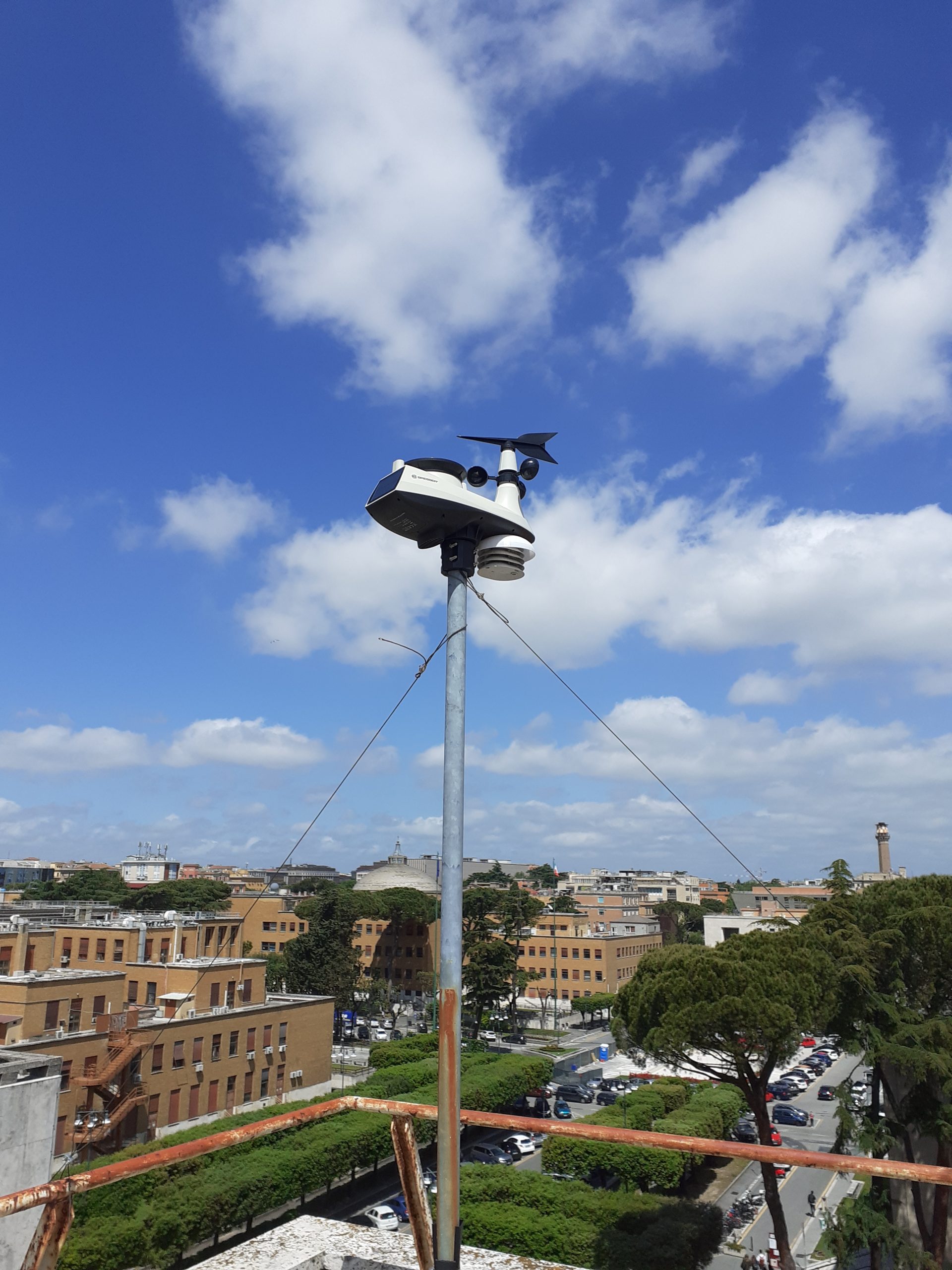
Meteo Sensors SCO
The second weather station installed in the Super Site BAQUNIN is managed by the Sardegna Clima Onlus non-profic Organisation. The weather station (Davis Vue 6357), installed on the roof of the Department since January 2021, is composed by two components: the Sensor Suite which hosts and manages the external sensor array, and the internal console which provides the user interface, data display, and relevant calculations. The station provides real-time measurements of temperature, rain, dewpoint, atmospheric pressure, wind speed, wind direction and UV index.
WEB: https://sardegna-clima.it/
PI: Enrico Cadau

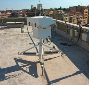
Pyranometer
The Pyranometer measures the solar radiation received by a plane surface from a 180° field of view angle. This quantity, expressed in W/m2, is called “hemispherical” solar radiation.
Pyranometer model is SR11 produced by Hukseflux Thermal Sensor Company. The solar radiation spectrum extends roughly from 285 to 3000 x 10-9 m. It is a high accuracy solar radiation sensor and it complies with the first class specifications of the ISO 9060 standard and the WMO Guide.It is connected directly to commonly used data logging systems. The irradiance, E, in W/m2 is calculated by dividing the SR11 output, a small voltage U, by the sensitivity S. The sensitivity is provided with SR11 on its calibration certificate. Traceability of calibration is to the WRR (World Radiometric Reference) maintained at the World Radiation Center in Davos, Switzerland.
PI: Anna Maria Iannarelli

TropEx ROIs over Italy and Thule USA air base in Greenland
TROPOMI is an atmospheric observation instrument on board the Copernicus Sentinel-5 Precursor satellite. The Sentinel-5 Precursor (S5P) was launched on 13 October 2017, planned for a mission of seven years. The TROPOMI instrument has the capability of observing several key atmospheric species, needed for air quality, climate, and ozone layer monitoring services. TROPOMI files are distributed through the Copernicus S5P Hub and the ONDA Hub.
TROPOMI Level2 product files contain all the information collected during a S5P single orbit; a single file size can generally be of several hundreds of Mb size. Although these files provide a global picture of the retrieved quantities, the monitoring of a specified region could prove computationally heavy, due to the large quantity of data involved.
TropEx (TROPOMI Extractor) is a Serco service providing the extraction of TROPOMI files content on specified Regions of Interest (ROIs), thus producing smaller files more suitable for regional analysis. In the figure, the ROI actually used are shown.
TropEx checks every day the last TROPOMI files published on ONDA Hub, verifying for each ROI if an overpass is present; in this case, the file is downloaded, data referring to the ROI are extracted and an output file with the extraction results is produced and distributed through an FTP server.
More details about the extracted files can be found in the Technical Note.
Information for TropEx data access can be requested to the BAQUNIN team, using Contact us form.